|
USK
WALKS
|

|
|
|||||||
| HOMEPAGE |
|
Walk
No 6: Llangeview - Coed Cwnwr - Llanllowell - Usk Flood Route
(6½ miles - about 2¼ hours; directions last checked (not revised) on 05.11.25) Boots are recommended for this walk as the track through the wood is rough and often muddy. |
||
|
This is a
moderate walk with a long steep climb. There are no toilets or pubs, except
in Usk itself. |
||
|
|
|
Leave the town square by the south-east corner (i.e. the same side of the square as the Castle Inn) and proceed along Four Ash Street. Pass the former Greyhound Inn (now a private house) and continue on Chepstow Road. Turn right at the Olway Inn (formerly Casey's Court) and go up the steep hill. Continue along the lane, crossing above the dual carriageway. At the crossroads (where the Flood Route is signposted in two directions) go straight up the narrow lane. Continue uphill, ignoring after about 120 metres the parallel track on the right which leads to a house. |
|
At "Graig-Yr-Ieir" house (the white house
at the end of the lane), take the narrow, muddy and stony track up the
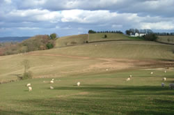
hill, through Mardy Hill Wood. At the top follow the track with a field
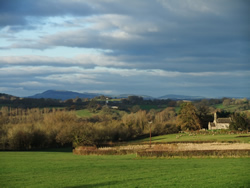
to the left and a hedge to the right. When visibility is good, there are
splendid views from here across to the hills surrounding Abergavenny.
Shortly after the next house on the left, follow the track round to the
right. Pass the entrance to the Springdale
Farm Nature Reserve (Gwent
Wildlife Trust).
|
|
|
|
|
|
After 7 minutes, in the hamlet of Coed
Cwnwr, take the lane to the right (where there is a postbox.) Follow this
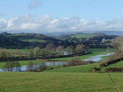
down the beautiful valley called Llewelyn's Dingle. Turn right at the
T-junction and go under the dual carriageway. Opposite
St
Llywel's Church in the hamlet of Llanllowell
take the lane on the right (signposted Usk Flood Route). |
|
Follow this to the T-junction by the Olway Inn and turn left. Follow the road back to the town square. |
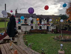 The Olway Inn, Usk |
|
|
A
laminated A5 card showing this walk route, along with photographs, can
be easily ordered here.
The walk can be ordered more cheaply in digital format (PDF file) on the alternative Order Form. |
|
return
to top >>>
|